As the boundary tension between Liberia and Guinea intensifies, a detailed international boundary study by the United States Department of State has shed new light on the complex history and lingering ambiguities surrounding the Guinea–Liberia border, revealing a legacy of colonial-era agreements, territorial concessions, and unresolved technical disputes.
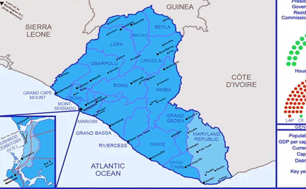
According to a report produced by the Office of the Geographer under the Bureau of Intelligence and Research, the approximately 350-mile boundary traces a series of agreements between Liberia and France dating back to the late 19th and early 20th Centuries.
These agreements significantly reshaped Liberia’s territorial extent and continue to influence boundary interpretations today. According to the study, a major turning point came in 1907 when Liberia and France agreed to abandon earlier theoretical boundary lines in favor of natural geographic features such as rivers. That decision led to the transfer of a “large strip” of Liberian territory to what was then French Guinea, shifting the boundary eastward toward the Nimba mountain range.
The boundary today, according to the report, follows a complex mix of riverbanks, mountain summits, and straight-line segments marked by pillars installed during a joint Franco–Liberian commission between 1926 and 1929.
However, the report highlights that the commission’s findings were never formalized into a comprehensive treaty, leaving room for uncertainty. One of the key sources of dispute identified in the study involves disagreements over whether river boundaries should follow the Liberian bank, as stated in earlier agreements, or the mid-channel, also known as the thalweg. Conflicting interpretations of river names and locations, some of which vary across local usage, have further complicated matters.
The study also recounts earlier territorial adjustments involving neighboring Sierra Leone, which shifted the tri-border point eastward in 1911, adding another layer of complexity to the boundary framework.
Despite these challenges, the report confirms that the general alignment of the boundary is known, running through major rivers such as the Makona, Loffa, and Mani, and across key landmarks including Mount Gabigisi and the resource-rich Nimba Range.
The historical findings come amid ongoing regional attention to border management, natural resource control, and cross-border security between Liberia and Guinea. However, while no immediate conflict is reported, the revelations highlight how colonial-era decisions continue to shape modern African borders, often with lasting political and economic consequences. The Department of State emphasized that the study is part of a broader effort to document international boundaries worldwide, providing technical insight rather than policy direction.